About
Palisade Irrigation District
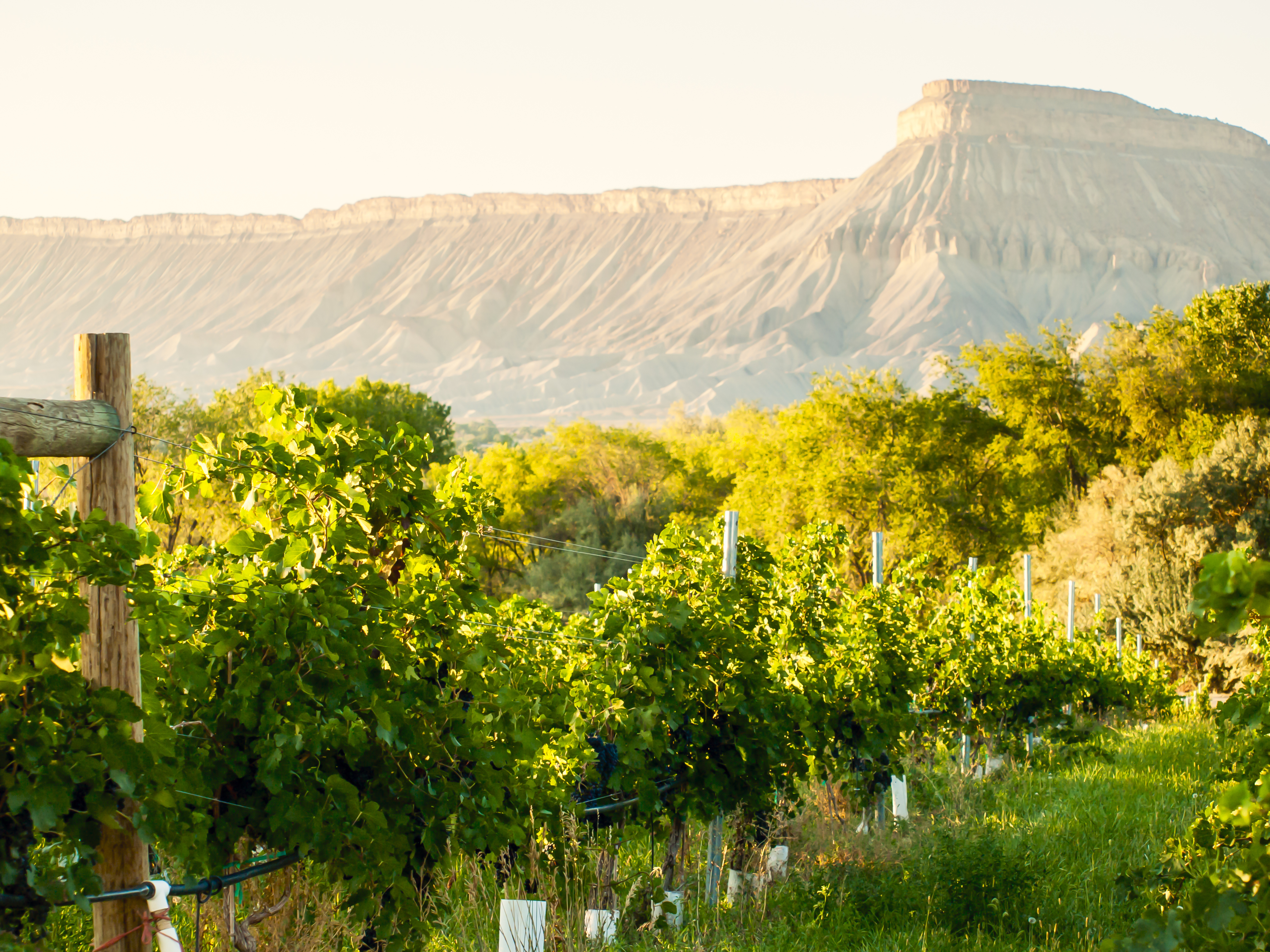
The Palisade Irrigation District delivers irrigation water from the Colorado River to a wide variety of agricultural enterprises in the eastern portion of the Grand Valley of west-central Colorado. Within the District you can find world-acclaimed vineyards and orchards including pear, peach, apricot, cherry, and apple. Hay, corn, alfalfa, vegetable farms, and hops are also grown.
The Grand Valley Water Users Association delivers Colorado River water from their Cameo Diversion or “Roller Dam” to the District through the Government Highline Canal. The majority of the District’s water right is diverted from the Government Highline Canal as it enters the Grand Valley and flows into the Price Ditch, the District’s main conveyance conduit. The Price Ditch really isn’t a ditch at all anymore. It was converted to a large diameter pipe through the federally funded Salinity Program in the mid-1990’s. Prior to that time, the District’s main responsibility was to simply ensure there was water enough in the Price Ditch to serve the 200 or so headgates stretching along its 9 plus mile course. This was accomplished by one ditchrider who regularly rode the ditch either by horseback or pickup setting headgates and clearing the ditch from debris.

As part of the Salinity Program, water users were asked if they would like to participate in a plan to pipe their laterals and turn operation and maintenance over to the District. As a result, about 70 laterals comprising about 50 miles of dirt ditch were piped and are currently operated and maintained by the District’s two full time employees. Still some lateral owners chose not to participate leaving many laterals unimproved. The District is not responsible for operating and maintaining private and/or unimproved laterals.
The District is relatively small occupying roughly 6000 acres with its eastern boundary laying to the northeast of the town of Palisade where Interstate 70 exits De Beque Canyon. The District’s northern boundary is generally the Price Ditch alignment south of the Government Highline Canal extending from Palisade west to about 28 ¾ Rd. The south boundary of the District is generally the privately owned Grand Valley Irrigation Company canal. Today, of more than 8,000 parcels the District serves, only about 700 are over an acre in size.
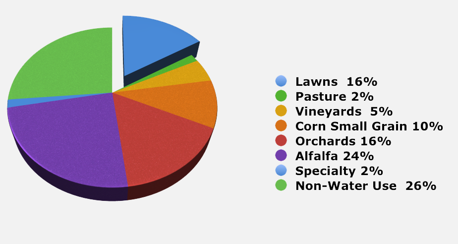
Palisade Irrigation District Estimated Crop Distribution
Palisade Irrigation District delivers irrigation water to over 8,800 parcels in the eastern portion of the Grand Valley, of Western Colorado. The District is comprised of about 6,250 acres of which 3,600 acres are used for agricultural crops or grazing and another 1,000 acres are lawns. The estimated crop mix is: 1,500 acres of alfalfa hay, 1,000 acres of orchards, 300 acres of vineyards, 600 acres of corn and small grain, 100 acres of grass pasture, and 100 acres of specialty crops such as hops, lavender, and vegetables. It is estimated that there are 1,000 acres of lawn with the remaining acreage comprised of infrastructure or other non-use areas.

Our History
Water and land development in the Grand Valley began in earnest in about 1890. Two companies, the Mount Lincoln Land and Water Co and Highline Mutual Irrigation Co worked for several years in the late 1890’s and early 1900’s to develop water delivery systems using hydraulic pumps and ditches. These early years were wrought with problems involving floods, ditch failures, and financial difficulties. Construction efforts in these early years were the beginnings of the Mesa County Irrigation District’s Stub Ditch (Canal No. 2) and the Palisade Irrigation District’s Price Ditch (Canal No. 1).
The Palisade Irrigation District was established in December of 1904 by a vote of “freeholders” in the district. The District was authorized by action of the Commissioners of Mesa County the following month. The District is an irrigation district organized under Colorado Statutes, which furnishes irrigation water to its users.
Did You Know?
1 share of Palisade Irrigation District Water is about 5.8 gallons per minute or about what 1 sprinkler uses.
Our Operations
Generally, each year, water is turned into PID’s Price Ditch sometime during the first two weeks in April and turned off during the last week of October. At the start of the irrigation season, water is diverted to the Salinity Laterals immediately upon the filling of the Price Ditch. At the same time, private headgates are unlocked allowing water users access to their water. Within the first few days, laterals are usually fully charged and operational. During the first two weeks of operation, field crews are generally engaged in isolating and repairing leaks or breaks. Water users on each lateral are generally responsible for sharing or rotating the water amongst themselves. Water users should not operate underground valves on Salinity laterals.
Water users in subdivisions should contact their HOA in the event of an outage or emergency prior to contacting the District.

